| About | 3D Scans | Panoramas (Bird's-Eye-Views) |
Detailed
Old Maps |
Railroads | Gold Claims | Our LIDAR Sliders! | Misc Projects |
Menotomy Maps
Established 1988
All pictures and text in these pages are (c)2023 Menotomy Maps(tm) and may not be used in any form without written permission from Menotomy Maps(tm).
 3D Scans
 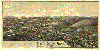 Historic Panoramas
(Bird's-Eye-Views from the 1800s)
Historic Panoramas
(Bird's-Eye-Views from the 1800s)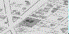 Old Maps showing property owners
in the 1800s
Old Maps showing property owners
in the 1800s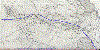 Old Railroad Maps
  Old Gold Claims Maps
 Our LIDAR Sliders!
 Miscellaneous Map Projects